
A few weeks ago I posted about visiting Victoria Peak when in Hong Kong – the hard bit is getting clear weather so you can actually see anything.
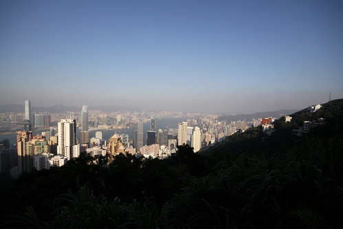
When visibility is good, you can see past Victoria Harbour towards the Kowloon Peninsula and the old airport, and into the hills that surround Kowloon. When you look really closely (with binoculars or a telephoto lens) then just to the right hand side of the Bank of China building, sticking out like a sore thumb is an entire mountain with a 20-odd-storey high gouge cut into the side.
On my previous visits I have also seen this massive cut in the side of the hill, but why is it there?
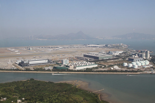
Massive man-made alterations to the terrain are not a new thing in Hong Kong: compared to 150 years ago, Hong Kong Island is around 1 kilometres closer to Kowloon, thanks to ongoing land reclamation along the shoreline of Victoria Harbour, as seen in the diagram below. The long “finger” jutting out into the harbour is the main runway at the the former Kai Tak airport, the majority of which was also located on reclaimed land.
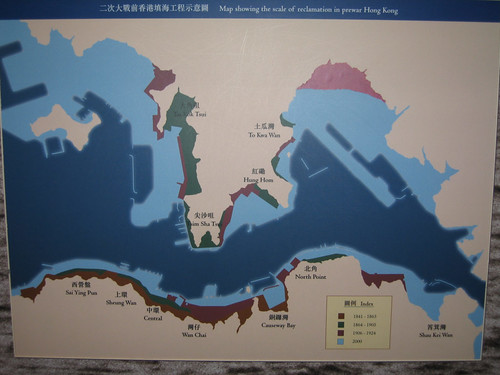
What the map doesn’t show is Hong Kong’s other major land reclamation projects of the past 40 years: the New Towns of Sha Tin, Ma On Shan, Tai Po and Tuen Mun are located on reclaimed lowlands at foot of mountains, where wide rivers once joined the ocean.
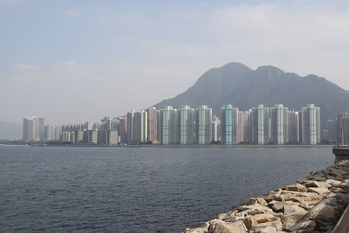
An even bigger project was construction of the current airport at Chek Lap Kok in the 1990s: located on an artificial island created after two existing islands were bulldozed into the ocean.
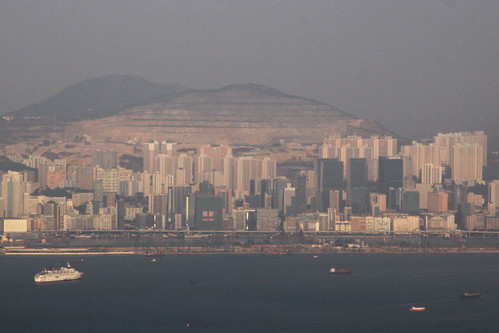
As for the missing hillside, I finally got a better view of it when I caught the Star Ferry over to Hung Hom.
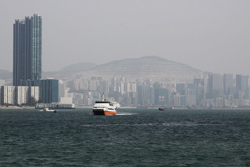
The hillside is located behind Kwun Tong, with a row of 30-story high buildings sitting in front it.
Fortunately, the additional reference points made it possible to locate the hillside on a map, but didn’t answer my main question: why is it there?

With a bit of searching around the internet I found Wikimapia, a Wiki based website where people can tag locations against a satellite maps. There I found my mystery hillside tagged as “Anderson Road Quarry” – so mystery solved.
After doing some more digging, I found out that the quarry opened in 1956, in 1997 it took the form it is today, with the quarry due for closure in 2013 and rehabilitation of the site to follow. The quarry covers 86 hectares, the working face itself is 200 metres high and extends over 1.5 km along the hillside.
Here are a few more links about the Anderson Road quarry:

Its a real human tragedy to see the Anderson Quarry hillside today. I spent many hours staring at that hillside as a boy. Having spent the first 9 years or so of my life living in one of those flats in upper Sau Mau Ping. I left HK some 25 years ago. I wonder if this hillside will even be there in another 20 years.
Turns out excavation started at the quarry way back in 1956:
http://industrialhistoryhk.org/anderson-road-quarry/
The quarry is now home to public housing estates:
On Tai and On Tat Estates if you’re interested.
Thanks for that – looks like both estates only occupy the edge of the former quarry:
https://www.google.com.au/maps/place/On+Tai+Estate,+Hong+Kong/@22.3249349,114.2296175,2945m/data=!3m1!1e3!4m5!3m4!1s0x340406add7b69171:0xf00ac830c808f804!8m2!3d22.3271529!4d114.2290191
Development plans for the rest of the site are here:
http://www.arqs.hk/about.php