
When I go on holiday I take a lot of photos, and when I get home and upload them, I make sure I caption them accurately. Getting the location correct is easy to do when I geotag the photos, but sometimes I forget to carry my GPS datalogger with me, which results in photos like the one below, where I don’t have any location information to go with it.
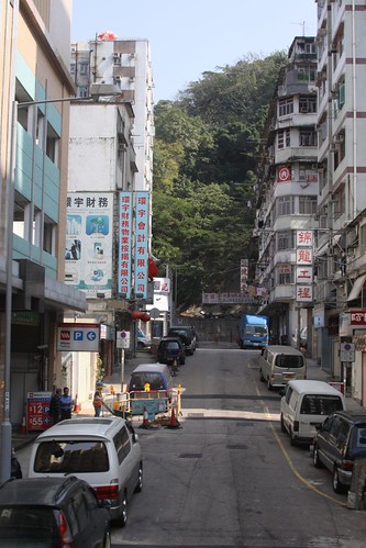
Thankfully I took a number of other photos about 30 minutes either side of this one, and once I visit somewhere, I’m usually able to find it again on a map with a bit of digging around. In the case of the photo above I was travelling on a bus between my 姑媽’s (father’s elder sister) house in the New Territories and Tsim Sha Tsui, crossing the Kowloon Hills via Tai Po Road.
With that in mind, I jumped on Google Maps and followed Tai Po Road down from the hills towards Kowloon, looking for side streets that faced a hillside. After a bit of scrolling around, I finally found the same street as my photo – Wong Chuk Street, Sham Shui Po, Kowloon, Hong Kong.
On closer inspection the same grey and white van is parked in both photos, and the price of carpark is the same – $12 an hour or $55 per day.
